Tag Archives: Amelia Earhart

30 June 1937

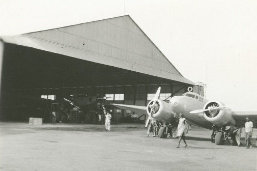
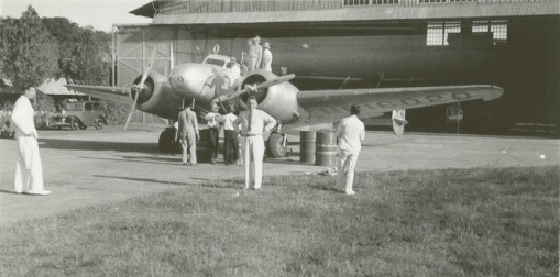
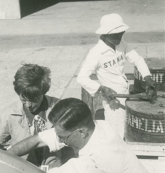
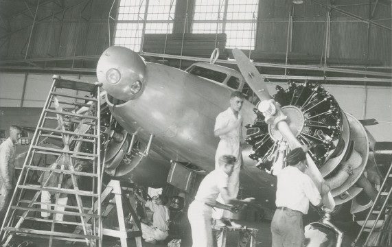
Amelia Earhart with her Lockheed Electra 10E Special, NR16020, at Lae, Territory of New Guinea.

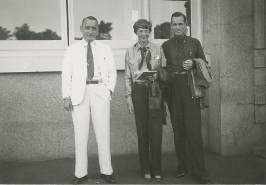
30 June 1937. Amelia Earhart and Fred Noonan are delayed at Lae, Territory of New Guinea.

“Everyone has been as helpful and co-operative as possible—food, hot baths, mechanical service, radio and weather reports, advice from veteran pilots here—all combine to make us wish we could stay. However, tomorrow we should be rolling down the runway, bound for points east. Whether everything to be done can be done within this time remains to be seen. If not, we cannot be home by the Fourth of July as we had hoped, even though we are one day up on the calendar of California. It is Wednesday here, but Tuesday there. On this next hop we cross the 180th Meridian, the international dateline when clocks turn back twenty-four hours.”

—Amelia Earhart

© 2016, Bryan R. Swopes

29 June 1937

Photo of a replica of Earhart's Lockheed Electra 10E, flown by Linda Finch. (Tony Bacewicz / The Hartford Courant)
This is a photograph of Linda Finch’s Lockheed Electra over the Arafura Sea at sunset, 8 May 1997, as she recreated the flight of Amelia Earhart. (Tony Bacewicz /The Hartford Courant)

29 June 1937: Leg 28.  Amelia Earhart and Fred Noonan fly the Lockheed Electra 10E, NR16020, from Darwin, Northern Territory, Australia, to Lae, Territory of New Guinea.

“Lae, New Guinea, June 30th. After a flight of seven hours and forty-three minutes from Port Darwin, Australia, against head winds as usual, my Electra now rests on the shores of the Pacific. Beyond the Gulf of Huon the waters stretch into the distance. Somewhere beyond the horizon lies California. Twenty-two thousand miles have been covered so far. There are 7,000 to go.

“From Darwin we held a little north of east, cutting across the Wellington Hills on the northern coast of Arnhem Land, which is the topmost region of Australia’s Northern Territory. The distance to Lae was about 1,200 miles. Perhaps two-thirds of it was over water, the Arafura Sea, Torres Strait and the Gulf of Papua.

“Midway to New Guinea the sea is spotted with freakish islands, stony fingers pointing towards the sky sometimes for hundreds of feet. We had been told the clouds often hang low over this region and it was better to climb above its hazardous minarets than to run the risks of dodging them should we lay our course close to the surface. Then, too, a high mountain range stretches the length of New Guinea from northwest to southeast. Port Moresby was on the nearer side, but it was necessary to clamber over the divide to reach Lae situated on the low land of the eastern shore. As the journey progressed we gradually increased our altitude to more than 11,000 feet to surmount the lower clouds encountered. Even at that, above us towered cumulus turrets, mushrooming miraculously and cast into endless designs by the lights and shadows of the lowering sun. It was a fairy-story sky country, peopled with grotesque cloud creatures who eyed us with ancient wisdom as we threaded our way through its shining white valleys. But the mountains of cloud were only dank gray mist when we barged into them, that was healthier than playing hide-and-seek with unknown mountains of terra firma below. Finally, when dead reckoning indicated we had traveled far enough, we let down gingerly. The thinning clouds obligingly withdrew and we found ourselves where we should be, on the western flanks of the range with the coastline soon blow us. Working along it, we found Lae and sat down. We were thankful we had been able to make our way successfully over those remote regions of sea and jungle – strangers in a strange land.”

—Amelia Earhart

Great Circle route from Darwin, Northern Territory, Australia, to Lae, Territory of New Guinea, 1,002 nautical miles (1,153 statute miles/1,856 kilometers). (Great Circle Mapper)

© 2019, Bryan R. Swopes

28 June 1937

Amelia Earhart’s Lockheed Electra 10E NR16020 at Darwin, Northern Territory, Australia, 28 June 1937. (Purdue University Libraries, Archives and Special Collections)

28 June 1937: Leg 27. Koepang, Timor, Dutch East Indies to Darwin, Northern Territory, Australia.

“We crossed the Timor Sea from Koepang, on Timor Island, in three hours and twenty-nine minutes against strong head winds. We flew over fleecy clouds at a height of 7,000 feet. . .

Amelia Earhart on the wing of her Electra at Darwin, Northern Territory, Australia, 28 June 1937. (Unattributed)

“The country of this northern coast of Australia is very different from that surrounding Koepang. There jagged mountains rose against the dawn, while here, as far as one could see, were endless trees on an endless plain. The airport is good and very easy to find. We were pounced upon by a doctor as we rolled to a stop, and thereupon were examined thoroughly for tropical diseases. No one could approach us or the airplane until we had passed muster. If this work is done at all it should be thorough, and I approved the methods, although the formalities delayed refueling operations. The customs officials had to clear the Electra as if she were an ocean-going vessel, but that was done with much dispatch. Inasmuch as we had little in the plane but spare parts, fuel and oil, the process was simplified. At Darwin, by the way, we left the parachutes we had carried that far, to be shipped home. A parachute would not help over the Pacific.”

—Amelia Earhart

Amelia Earhart and Fred Noonan at Darwin, Northern Territory, Australia, 28 June 1937. (Purdue)
Amelia Earhart and Fred Noonan at Darwin, Northern Territory, Australia, 28 June 1937. (Purdue University Libraries, Archives and Special Collections)
Great Circle route from Koepang, Timor, Dutch East Indies, to Darwin, Northern Territory, Australia, 445 nautical miles (513 statute miles/825 kilometers). (Great Circle Mapper)

© 2019, Bryan R. Swopes

27 June 1937

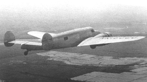
Amelia Earhart’s Lockheed Electra 10E Special, NR16020, over Java, Dutch East Indies, June 1937.

27 June 1937: Leg 26. Bandoeng, Java, to Koepang, Timor, Dutch East Indies.

“Finally on Sunday, June 27, we left Bandoeng. I had hoped to be able to keep on to Port Darwin on the northern coast of Australia, but the penalty for flying east is losing hours. Depending on the distance covered, each day is shortened and one has to be careful to keep the corrected sunset time in mind so as not to be caught out after dark. For instance, between Koepang and Australia there is a loss of one and a half hours. So, as our landing in Koepang five hours after our start was too late to permit safely carrying on to Darwin that day, we settled down overnight in the pleasant Government rest house, planning to leave the airport at our conventional departure time, dawn. Koepang is on the southerly tip of the island of Timor, the last outpost of the archipelago of Holland-owned islands which string out southeasterly from Sumatra. As a matter of fact half of Timor is not under Dutch but Portuguese control. In the flight from Bandoeng the first 400 miles was over the lovely garden-land of Java. Then we looked down briefly upon Bali, much photographed island of quaint dancers, lovely costumes, lovelier natives, a well-publicized earthy heaven of dulce far niente. Thence we passed over Sujmbawa island, skirted Flores, and cut across a broad arm of the Arafura Sea toward Timor.

“As we left Java the geographic characteristics began to change. From lush tropics the countryside became progressively arid. The appearance of Timor itself is vastly different from that of Java. The climate is very dry, the trees and vegetation sparse. There was little or no cultivation in the open spaces around the airport, the surface of which was grass, long, dry and undulating in a strong wind when we arrived. The field, surrounded by a stout stone fence to keep out roaming wild pigs, we found to be a very good natural landing place. There were no facilities except a little shed for storing fuel, consequently we had to stake down our Electra and bundle it up for the night with engine and propeller covers. That is an all-important job carefully done; no pilot could sleep peacefully without knowing that his plane was well cared for. Our work much amused the natives from a near-by village. When we had to turn the craft’s nose into the wind, all the men willingly and noisily helped us push it as desired.”

—Amelia Earhart

Photo of a replica of Earhart’s Lockheed Electra 10E, flown by Linda Finch. (Tony Bacewicz / The Hartford Courant)
A replica of Earhart’s Lockheed Electra 10E Special over the Arafura Sea, flown by Linda Finch, 1997. (Tony Bacewicz / The Hartford Courant)
Great Circle route from Bandoeng, Java, to Koepang, Timor, Dutch East Indies, 976 nautical miles (1,124 statute miles/1,808 kilometers). (Great Circle Mapper)

© 2019, Bryan R. Swopes

25 June 1937

25 June 1937: Leg 25. After flying from Bandoeng to Soerabaya the previous day, a problem with Amelia Earhart’s Lockheed Electra 10E Special, NR16020, could not be repaired there, forcing her to return to Bandoeng.

“In the air, and afterward, we found that our mechanical troubles had not been cured. Certain further adjustments of faulty long-distance flying instruments were necessary, and so I had to do one of the most difficult things I had ever done in aviation. Instead of keeping on I turned back the next day to Bandoeng. With good weather ahead, the Electra herself working perfectly, the pilot and navigator eager to go, it was especially hard to have to be “sensible.” However, lack of essential instruments in working order would increase unduly the hazards ahead. At Bandoeng were the admirable Dutch technicians and equipment, and wisdom directed we should return for their friendly succor. So again we imposed ourselves upon these good people to whom I shall be grateful always for their generosity and fine spirit. A particular niche in my memory is occupied by Colonel L.H.V. Oyen, Commander of the Air Force, H.A. Vreeburg, chief engineer, and so many K.N.I.L.M. personnel to whom I would like again to say ‘Thank you’.”

— Amelia Earhart

Amelia Earhart’s Lockheed Electra 10E Special, NR16020, at Bandoeng, Java, Dutch East Indies, June 1937. (Purdue University Libraries, Archives and Special Collections)
Bandoeng to Soerabaya, 352.26 miles (566.91 kilometers). (Google Maps)

© 2018, Bryan R. Swopes