Amelia Earhart and Fred Noonan at Natal, Brazil, 7 June 1937. (The Wichita Eagle)
6 June 1937: Leg 9. After a one-day layover at Fortaleza, Brazil, Amelia Earhart and Fred Noonan flew 267 miles (429 kilometers) to Natal and readied for their trans-Atlantic crossing the following day.
“We got into the air at 4:50 a.m. and arrived at Natal at 6:44, so our day’s work was done almost before conventional breakfast time. However, we had wanted to reach Natal early, on the chance we might start thence across the South Atlantic that evening.”
—Amelia Earhart
Straight line distance between Fortaleza and Natal, Brazil: 266.59 miles (429.04 kilometers). (Google Maps)
Chegando em Fortaleza com o capitão Noonan. (Fortaleza Nobre)
4 June 1937: On Leg 8 of their around-the-world flight, Amelia Earhart and her navigator, Fred Noonan, fly the Lockheed Electra 10E, NR16020, from Paramaribo, Nederlands Guiana (today, Suriname), to Fortaleza, Brazil, a distance of 1,330 miles (2,141 kilometers). They stay there to rest for a day.
“The weather at Paramaribo was perfect except for a morning mist from the Surinam River, when we took off to skim the tree-tops and then pull up. Speaking of trees, we had plenty of them on this jump to Fortaleza in Brazil – trees and water. During the day we flew over 960 miles of jungle, added to hops of 370 miles by compass course over open sea, a total of 1,330 miles, or a trifle more than half the transcontinental distance between New York and Los Angeles. . . After about ten hours’ flying I was glad to see Fortaleza sitting just where it should be, according to the maps, between the mountains and the sea, on a brown, sandy plain, in the arc of a crescent-shaped indentation just west of Cape Mucuripe. . . Fortaleza is a town of 100,000 people, a potent metropolis whose name few of us in North America have even heard. In my own ignorance I had thought of Natal as a more important place. That, of course, because Natal figures so largely in aviation matters. Fortaleza’s airport was so fine we decided to make final preparations for the South Atlantic hop there rather than at Natal, the actual jumping-off place for that much-flown stretch. . . .”
—Amelia Earhart
Amelia Earhart’s Lockheed L-10E Electra NR16020 at Fortaleza, Brazil. (Fortaleza Nobre)Great Circle route from Paramaribo, Suriname, to Fortaleza, Brazil, 1,142 nautical miles (1,314 statute miles/2,114 kilometers). (Great Circle Mapper)
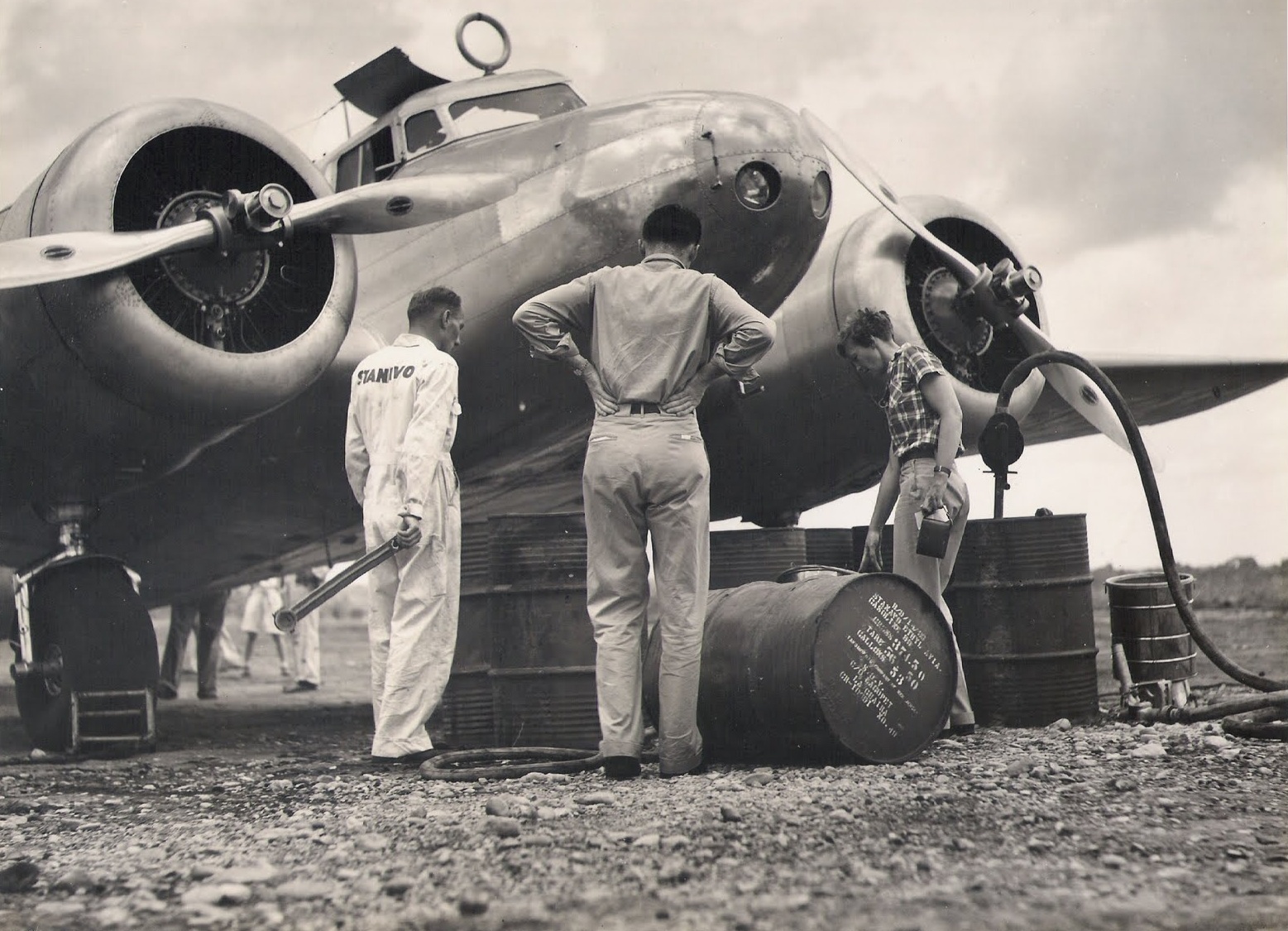
Amelia Earhart supervises refueling her Lockheed Electra 10E, NR16020, at Caripito, Venezuela. (Unattributed)
3 June 1937: Leg 7. Amelia flew her Electra from Caripito, Venezuela, to Paramaribo, Nederlands Guiana, a distance of 615 miles (990 kilometers). She arrived at 12:50 p.m., local time.
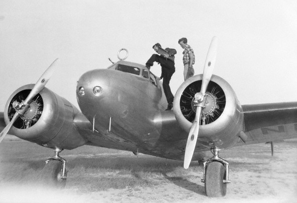
Amelia Earhart boards her Lockheed Electra 10E NR16020 at Caripito, Venezuela, 3 June 1937. (Unattributed)
Rain clouds hung thick about Caripito as we left on the morning of June third. We flew over jungles to the coast, and then played hide-and-seek with showers until I decided I had better forgo the scenery, such as it was, and climb up through the clouds into fair weather. An altitude of 5,000 feet topped all but the highest woolly pinnacles. . . Soon we saw the river Surinam, a silver streak meandering to the coast, a wide tidal stream full of floating green islands of small trees and water plants, and bordered with vast stretches of mud. Twelve miles from its mouth is Paramaribo, capital of Dutch Guiana, and twenty-five miles further inland the airport. . . No make-shift airport this, but one of the best natural landing areas I have ever seen. . . .
—Amelia Earhart
Amelia Earhart’s Lockheed Electra 10E, NR16020, departs Caripito for Paramaribo, 3 June 1937. (Purdue University Libraries, Archives and Special Collections)Amelia Earhart and Fred Noonan arrive at Paramaribo, Dutch Guiana, 3 June 1937. (Stichting Surinaams Museum)Great Circle route from Maturin, Venezuela, the closest existing airport to Caripito, to Paramaribo, Suriname: 539 nautical miles (621 statute miles/999 kilometers). (Great Circle Mapper)
Fred Noonan and Amelia Earhart board the Electra at San Juan, Puerto Rico, 2 June 1937. (Bettmann/CORBIS)
2 June 1937: After an overnight stay at San Juan, Puerto Rico, Amelia Earhart and Fred Noonan continued on Leg 6 of their around-the-world flight, to Caripito, Venezuela, approximately 611 miles (984 kilometers) southeast. They arrived at 1:18 p.m., local time.
“I rolled out of bed at a quarter of four in the morning, hoping to make a dawn take-off from San Juan, but actually the Electra did not lift her wheels from the runway until nearly seven o’clock, with the sun well above the horizon. . . I flew at 8,000 feet most of the way, bucking head winds of probably thirty miles an hour. . . The coast of Venezuela in the hazy distance was my first glimpse of South America. As we drew near I saw densely wooded mountains and between them wide valleys of open plains and jungle. I had never seen a jungle before. . . close-knit tropic jungles are in a pilot’s eyes about the least desirable of all possible landing places. . . A muddy river wound through the mountain pass we followed, a reddish-brown snake crawling among tight-packed greenery. A few miles inland lay the red-roofed town of Caripito, with squat oil tanks on the outskirts. There was a splendid airfield, with paved runways and a well-equipped hangar. It is managed jointly by Pan American Airways and the Standard Oil Company.“
—Amelia Earhart
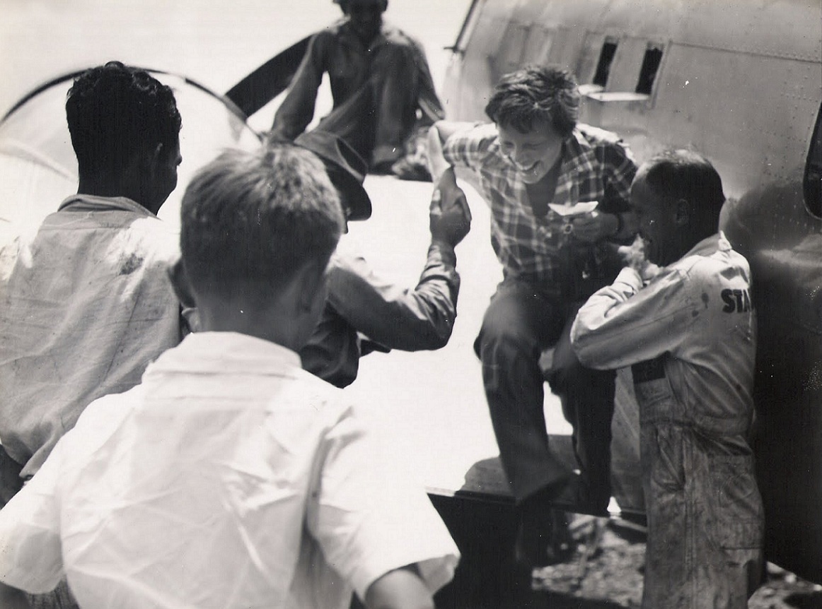
Amelia Earhart is greeted on her arrival at Caripito, Venezuela, 2 June 1937.Great Circle route from Isla Grande Airport, San Juan, Puerto Rico, to Maturin, Venezuela, location of the closest existing airport to Caripito. 548 nautical miles (630 statute miles/1,014 kilometers). (Great Circle Mapper)
Amelia Earhart prepares to leave Burbank, California, 21 May 1937.
21 May 1937: Day 2 of Amelia Earhart’s second attempt to fly around the world aboard her Lockheed Electra 10E, NR16020. She and her navigator, Fred Noonan, fly from Union Air Terminal, Burbank, California, to Tucson, Arizona, where they stopped to refuel. Earhart’s husband, George Palmer Putnam, and aircraft mechanic Ruckins D. “Bo” McKneely were also aboard. ¹
When Earhart attempted to restart the left engine at Tucson, it caught fire. An unplanned overnight stay was required while the damage was repaired.
“Accompanying me on this hop across the continent was Fred Noonan. “Bo” McKneely my mechanic, and Mr. Putnam. A leisurely afternoon’s flight ended at Tucson, Arizona. The weather was sailing hot as Arizona can be in summertime. After landing and checking in, when I started my motors again to taxi to the filling pit the left one back-fired and burst into flames. For a few seconds it was nip-and-tuck whether the fire would get away from us. There weren’t adequate extinguishers ready on the ground but fortunately the Lux apparatus built in the engine killed the fire. The damage was trivial, mostly some pungently cooked rubber fittings a deal of dirty grime. The engine required a good cleaning and the ship a face-washing.”
—Amelia Earhart
¹ Although the standard Lockheed Electra 10E was certified to carry up to 10 passengers, the Restricted certification of NR16020 limited it to, “Only bona fide members of the crew to be carried.” The presence of Putnam and McKneely violated this restriction.
Great Circle route from the location of the former Union Air Terminal (now, Hollywood-Burbank Airport) to Davis-Monthan AFB, Tucson, Arizona: 396 nautical miles (455 statute miles/733 kilometers). (Great Circle Mapper)