Reception for Amelia Earhart and Fred Noonan at Dakar, French West Africa. (Purdue University Libraries, Archives and Special Collections)
8 June 1937: Leg 11. After landing at Saint-Louis, French West Africa, the previous evening, Amelia Earhart and Fred Noonan reposition the Lockheed Electra 10E, NR16020, to Dakar, their intended destination. They lay over until 10 June for rest and maintenance on the airplane.
“On the morning of June 8 we flew the 163 miles from St. Louis. The chief reason I decided to lay over a day at Dakar instead of proceeding east was because my fuelmeter gave out two hours after we left Natal. The very efficient chief mechanic at Dakar discovered that a piece of the shaft was broken. While he worked on that – a difficult job to manage from a blueprint printed in English, which he did not understand, in an aeroplane he did not know – I had a forty-hour check of the engines, probably all they would need until we reached Karachi.”
—Amelia Earhart
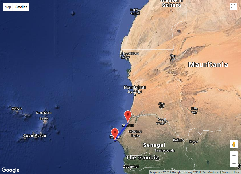
Amelia Earhart’s Lockheed Electra 10E NR16020 being serviced at Dakar, French West Africa. (Purdue University Libraries, Archives and Special Collections)Straight line distance Saint-Louis to Dakar, French West Africa: 112.16 miles (180.5 kilometers). (Google Maps)
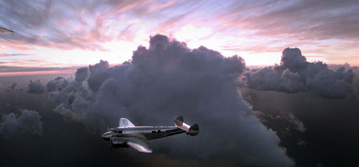
Photograph of a replica of Amelia Earhart’s Lockheed Electra 10E Special, NR16020, flown by Linda Finch. (Tony Bacewicz / The Hartford Courant)
7 June 1937: Leg 10—the South Atlantic Crossing. At 3:15 a.m., Amelia Earhart and Fred Noonan departed Natal, Brazil, aboard their Lockheed Electra 10E Special, NR16020, enroute across the South Atlantic Ocean to Dakar, Afrique occidentale française (now, Senegal).
It was 3.15 in the morning when we left Parnamirim Airport at Natal, Brazil. The take-off was in darkness. The longer runway, which has lights, was unavailable because a perverse wind blew exactly across it. So I used the secondary runway, whose surface is of grass. In the dark it was difficult even to find it, so Fred and I tramped its length with flashlights to learn what we could and establish something in the way of guiding landmarks, however shadowy. Withal, we got into the air easily. Once off the ground, a truly pitch dark encompassed us. However, the blackness of the night outside made all the more cheering the subdued lights of my cockpit, glowing on the instruments which showed the way through space as we headed east over the ocean. “The night is long that never finds the day,” and our night soon enough was day. I remembered, then, that this was my third dawn in flight over the Atlantic. . . .
— Amelia Earhart
Fred Noonan wrote in a letter from Dakar, “The flight from Natal, Brazil produced the worst weather we have experienced—heavy rain and dense cloud formations. . . .”
In her notes, Earhart wrote, “. . . Have never seen such rain. Props a blur in it. See nothing but rain now through wispy cloud. . . .”
— from Finding Amelia by Ric Gillespie, Naval Institute Press, 2006, Chapter 5 at page 41.
The poor weather made it impossible for Noonan to find their way across the ocean by celestial navigation, his field of expertise. Instead, he had to navigate by ded reckoning (short for deductive reckoning, not “dead”) and to estimate course corrections.
When they arrived over the African coastline at dusk, they knew that they were north of their intended course but haze caused very limited visibility. Navigational errors had caused them to miss Dakar, so they turned north until they came to Saint-Louis, where they landed after a 1,961 mile (3,156 kilometer), 13 hour, 22 minute flight.
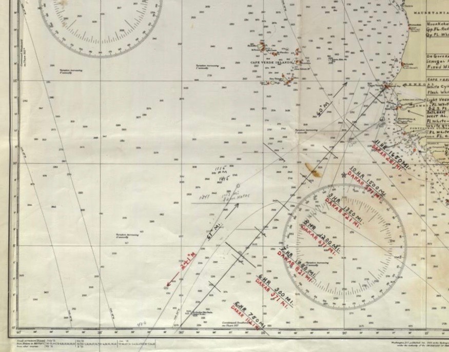
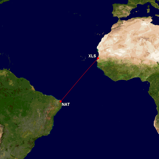
Fred Noonan’s nautical chart for a portion of the Natal-to-Dakar flight in the Purdue University archives. (Gary LaPook, NavList)Great Circle route from Parnamirim Airport (NAT), Natal, Brazil, to Saint-Louis Airport ( XLS), Senegal, 1,721 nautical miles (1,981 statute miles/3,188 kilometers). (Great Circle Mapper)
")
")